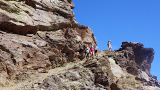

One of the more remarkable features of the Sierra Nevada range is the road that traverses the main ridge at around 3,000m. The road, an un surfaced dirt track, is now closed to all traffic, in summer however it is a clear route across the range and is popular with walkers, mountain bikers and occasionally horse riders.
The history of the road dates back to 1916 when it was thought that it would be possible to create a link from Granada to the Alpujarra across the mountains. Construction began from the west side of the range and in 1932 a section of the road reached 3,100m on the side of Veleta, the peak high above Granada. This section of road, now surfaced in parts, is still on the ground and is used to service the ski tows and chair lifts on the mountainside. This particular section is also mentioned by Wikipedia as the highest surfaced road in Europe.
During the civil war construction stopped and it wasn’t until the mid sixties when the link between Veleta and the south ridge of Mulhacen was opened. Once finished the route was open to all who wanted to venture across what would have been a very dramatic route which could be followed all the way from Granada to Capileira. This high sierra route was popular with drivers and remained open until the late nineties when the Parque Nacional was created and public access stopped.
Remarkable as it was in its own right, as well as the road, it was also envisaged that a tunnel would be constructed below Veleta which would be used as a part of the route. Work on the tunnel was started from both sides of the St Juan ridge on the north side of the mountain. The work however was stopped by the onset of the civil war and never restarted after. The eastern entrance to the tunnel is still open and lies in the Coral de Veleta below the path known as the Verdon Superior. The ‘’tunnel’’ is about 50m deep and is often used as a bivouac site by mountaineers.
When I first started walking in the Sierra Nevada I bought a copy of what was then the only English guide book to the area. That first edition of ‘’Walking in the Sierra Nevada’’ has a number of routes from the road and describes one route up Mulhacen which involved parking your car at 3,000m and walking the last 400m up the west ridge. It even describes a branch of the road that ran to a parking area on the south ridge itself which would require any intrepid “mountaineer” to walk a kilometre and ascend 75m before reaching the top!


 One of the more remarkable features of the Sierra Nevada range is the road that traverses the main ridge at around 3,000m. The road, an un surfaced dirt track, is now closed to all traffic, in summer however it is a clear route across the range and is popular with walkers, mountain bikers and occasionally horse riders.
The history of the road dates back to 1916 when it was thought that it would be possible to create a link from Granada to the Alpujarra across the mountains. Construction began from the west side of the range and in 1932 a section of the road reached 3,100m on the side of Veleta, the peak high above Granada. This section of road, now surfaced in parts, is still on the ground and is used to service the ski tows and chair lifts on the mountainside. This particular section is also mentioned by Wikipedia as the highest surfaced road in Europe.
During the civil war construction stopped and it wasn’t until the mid sixties when the link between Veleta and the south ridge of Mulhacen was opened. Once finished the route was open to all who wanted to venture across what would have been a very dramatic route which could be followed all the way from Granada to Capileira. This high sierra route was popular with drivers and remained open until the late nineties when the Parque Nacional was created and public access stopped.
Remarkable as it was in its own right, as well as the road, it was also envisaged that a tunnel would be constructed below Veleta which would be used as a part of the route. Work on the tunnel was started from both sides of the St Juan ridge on the north side of the mountain. The work however was stopped by the onset of the civil war and never restarted after. The eastern entrance to the tunnel is still open and lies in the Coral de Veleta below the path known as the Verdon Superior. The ‘’tunnel’’ is about 50m deep and is often used as a bivouac site by mountaineers.
When I first started walking in the Sierra Nevada I bought a copy of what was then the only English guide book to the area. That first edition of ‘’Walking in the Sierra Nevada’’ has a number of routes from the road and describes one route up Mulhacen which involved parking your car at 3,000m and walking the last 400m up the west ridge. It even describes a branch of the road that ran to a parking area on the south ridge itself which would require any intrepid “mountaineer” to walk a kilometre and ascend 75m before reaching the top!
One of the more remarkable features of the Sierra Nevada range is the road that traverses the main ridge at around 3,000m. The road, an un surfaced dirt track, is now closed to all traffic, in summer however it is a clear route across the range and is popular with walkers, mountain bikers and occasionally horse riders.
The history of the road dates back to 1916 when it was thought that it would be possible to create a link from Granada to the Alpujarra across the mountains. Construction began from the west side of the range and in 1932 a section of the road reached 3,100m on the side of Veleta, the peak high above Granada. This section of road, now surfaced in parts, is still on the ground and is used to service the ski tows and chair lifts on the mountainside. This particular section is also mentioned by Wikipedia as the highest surfaced road in Europe.
During the civil war construction stopped and it wasn’t until the mid sixties when the link between Veleta and the south ridge of Mulhacen was opened. Once finished the route was open to all who wanted to venture across what would have been a very dramatic route which could be followed all the way from Granada to Capileira. This high sierra route was popular with drivers and remained open until the late nineties when the Parque Nacional was created and public access stopped.
Remarkable as it was in its own right, as well as the road, it was also envisaged that a tunnel would be constructed below Veleta which would be used as a part of the route. Work on the tunnel was started from both sides of the St Juan ridge on the north side of the mountain. The work however was stopped by the onset of the civil war and never restarted after. The eastern entrance to the tunnel is still open and lies in the Coral de Veleta below the path known as the Verdon Superior. The ‘’tunnel’’ is about 50m deep and is often used as a bivouac site by mountaineers.
When I first started walking in the Sierra Nevada I bought a copy of what was then the only English guide book to the area. That first edition of ‘’Walking in the Sierra Nevada’’ has a number of routes from the road and describes one route up Mulhacen which involved parking your car at 3,000m and walking the last 400m up the west ridge. It even describes a branch of the road that ran to a parking area on the south ridge itself which would require any intrepid “mountaineer” to walk a kilometre and ascend 75m before reaching the top!
No comments:
Post a Comment
Note: only a member of this blog may post a comment.